
 FRANÇAIS
 ESPAÑOL
 PORTUGUÊS
 日本の
 简体中文
 한국어
CASE STUDY
Accelerating Defense Mapping with Phase One Cameras and Correlator3D
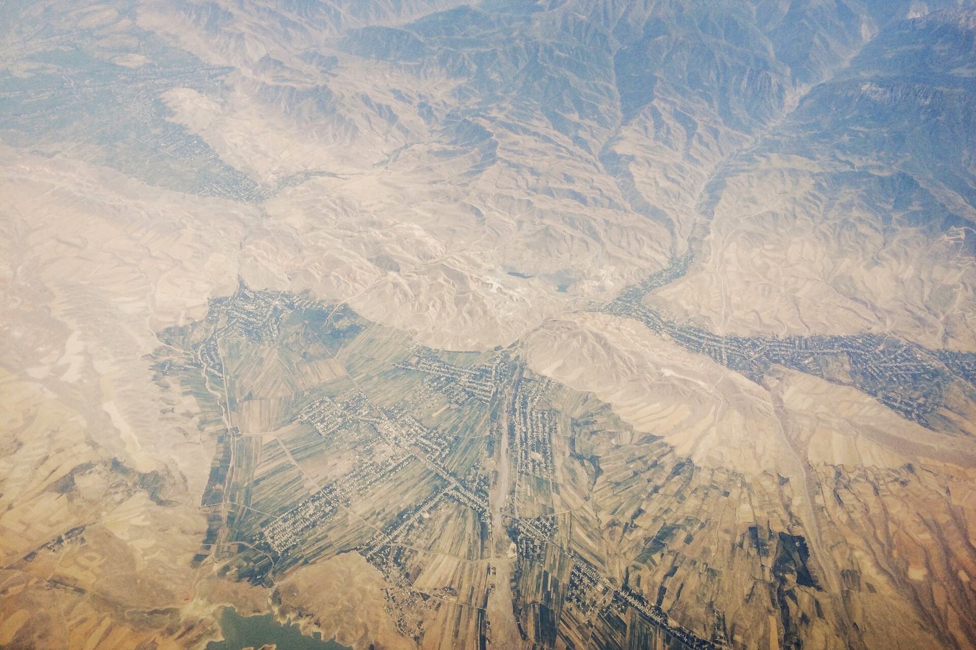
Defense and security organizations need current mapping information to understand terrain, plan missions, and monitor areas of interest. When aircraft collect thousands of high-resolution images each day, the challenge extends beyond acquisition: that imagery must quickly become usable maps.
Phase One and SimActive connect aerial imaging with scalable photogrammetric processing. Phase One cameras capture detailed imagery, while Correlator3D™ automates its transformation into orthomosaics and elevation models. The combined solution supports operational workflows ranging from military mapping to helicopter-based border patrol.
INDUSTRY
Defense and Security
COUNTRY
Worldwide
USE CASE
Large-scale mapping, reconnaissance, mission planning, and border patrol
CHALLENGES
- Turning large volumes of high-resolution imagery into maps under tight deadlines
- Keeping production moving as multiple aircraft collect imagery throughout the year
- Reducing the processing workload for non-specialist operators
- Maintaining consistent mapping quality across repeated acquisitions
BENEFITS
- Direct ingestion of Phase One imagery into Correlator3D
- Automated workflows from imagery to orthomosaics and elevation models
- Distributed processing to expand capacity across multiple computers
- Production on in-house infrastructure, with tools to inspect and refine results


“We have many end users collecting 10,000 to 50,000 large-format images a day. Our integration with SimActive reduces manual work and helps turn that imagery into usable mapping products faster.”
JACOB HUT
APPLICATION ENGINEERING DIRECTOR AT PHASE ONE
DEFENSE AND SECURITY APPLICATIONS
Rapid military mapping at scale
Military mapping operations can involve dozens of Phase One cameras collecting imagery over conflict zones and secured sites. These large-format sensors generate substantial datasets, with rapid orthomosaic production essential to delivering current mapping information.
For year-round collection, Correlator3D provides automated workflows suited to non-specialist operators. Processing can be distributed across multiple machines or deployed within an in-house cloud to scale production as requirements grow.
Supporting border patrol from the air
Border patrol operations can draw on fleets of helicopters equipped with Phase One cameras. Correlator3D transforms the collected imagery into mapping products that support patrol planning and monitoring of border areas.
With multiple aircraft contributing imagery, direct ingestion simplifies data preparation, automation reduces repetitive work, and distributed processing helps keep production aligned with collection volumes.
From mapping products to operational use
Orthomosaics and elevation models provide a common geographic reference for a range of defense and security activities:
• Surveillance and reconnaissance: Place newly collected imagery in geographic context and support the interpretation of areas of interest.
• Mission planning: Provide detailed mapping and terrain information for assessing routes, access, and operating areas.
• Damage assessment: Support comparison of mapped conditions before and after an event.
• Border, event, and site security: Provide current mapping to support patrol planning and the assessment of facilities and surrounding terrain.
WORKFLOW
Aligning acquisition with delivery requirements
Sensor configuration, flight altitude, image overlap, and coverage influence both image collection and processing time. Phase One offers imaging configurations for different platforms and mission requirements, allowing teams to match acquisition to the detail and coverage needed.
Establishing output requirements before collection helps avoid unnecessary processing. Validating the complete workflow in advance also allows teams to prepare repeatable procedures for recurring missions.
Automating the path from imagery to maps
Correlator3D offers native support for Phase One’s proprietary IIQ format, allowing direct ingestion without a separate image-conversion step. Automated workflows then handle aerial triangulation, elevation model generation, orthorectification, and mosaicking.
Scripting extends automation from project creation through final output. Once processing parameters have been established and validated, operators can run repeatable production workflows with fewer manual interactions. Specialists retain access to individual modules for quality control and refinement.
Scaling processing with collection capacity
Large image collections require both automation and computing capacity. Correlator3D distributes processing across multiple stations, helping shorten turnaround times for demanding datasets, including imagery from sensors with resolutions of 150 megapixels and higher.
Deployment across multiple machines and in-house cloud infrastructure supports sustained production. Organizations can expand processing capacity within their own computing environment as collection requirements increase.
DELIVERABLES
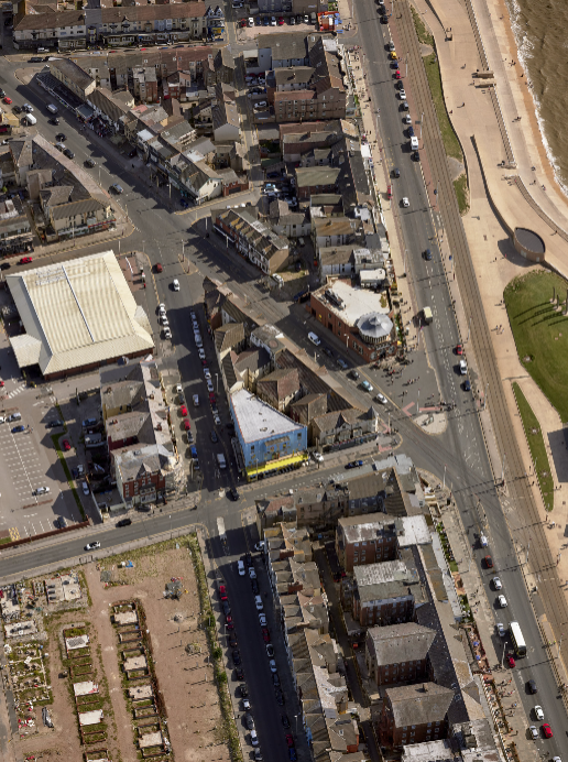
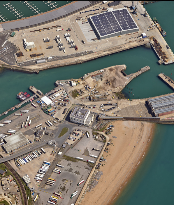
Rapid orthomosaics provide a detailed, geographically consistent view of the operating area. Digital surface models and digital terrain models add elevation information for terrain analysis and planning.
Teams can adapt output resolution and image bit depth to their requirements. Correlator3D also provides tools to inspect aerial triangulation, edit elevation models, and refine mosaic results within the same processing environment.
OPERATIONAL BENEFITS
For defense and security users, the value lies in keeping map production aligned with collection. Direct ingestion reduces preparation, automation lowers operator workload, and distributed processing helps accommodate imagery from multiple aircraft and high-resolution sensors.
Together, Phase One and SimActive support a repeatable path from aerial acquisition to usable mapping products, helping organizations deliver current geographic information under demanding operational timelines.
ABOUT THE SOLUTION
Phase One provides aerial imaging systems for geospatial applications. SimActive’s Correlator3D transforms aerial imagery into mapping products through automated photogrammetric processing. Their integration combines high-resolution acquisition with scalable production for defense and security workflows.