CASE STUDY

Pandemic Makes Remote Construction Site Monitoring the New Normal


The pandemic we are currently experiencing has changed the way we work. As remote work has become a common practice, so too has remote construction site monitoring. Another effect of the pandemic is a construction boom related to the onshoring of vital products to solve global supply chain issues. Extreme Aerial, a drone photography company based in Phoenix Arizona, is on top of this new construction boom in the Valley, providing remote construction site monitoring of one of the largest semiconductor manufacturers facilities.

Mark Taylor, Chief Geek at Extreme Aerial has been capturing imagery for a wide variety of clients since 2014. When these services include mapping, SimActive’s Correlator3D is key to Mark’s processing workflow.


TSMC-Header-xl
INDUSTRY

Construction


COUNTRY

United States


USE CASE

Using aerial imagery to monitor progress on construction sites over the buildout cycle.


CHALLENGES
  • Campus size facilities
  • Lifecycle extends over multiple years
  • Multiple stakeholders, multiple deliverables
  • Biweekly acquisition schedule


BENEFITS
  • Homogeneous deliverables
  • Digital elevations models
  • Color-balanced mosaic creation
  • Real-time seamline editing
  • Script-based processing
Exreme_Aerial_Logo
Mark  Taylor

“The desert southwest is an excellent place for photogrammetry,” said Mark Taylor. “The built-in scripting capabilities found in Correlator3D allow us to efficiently deliver consistent datasets for our site monitoring, topo and volumetric projects.”

MARK TAYLOR

CHIEF GEEK AT EXTREME AERIAL

TSMC-Arizona_wide

WORKFLOW


One such project Mark’s team has been working on has them capturing images and delivering datasets on a weekly basis for a construction project that spans period of years. Once the project scope and deliverables are defined, an acquisition schedule is set and flights begin. A generic script is generated in Correlator3D prior to flights to capture the desired deliverables. Incoming data is then processed, and an initial QC is completed. If adjustments are needed, the team will modify the script, otherwise it is saved for future missions. Employing the same script over the life of the project ensures homogenous deliverables over the life of the project. Once mosaics are produced, they are checked to ensure correct tonal balance and if there are no issues with seamlines. The DEMs are exported in TIF format along with contours for stakeholders to use in volumetric calculations. Using remote cameras either on the ground or in the air via drones such as Extreme Aerial provides reduce the need for additional personnel on site. This in turn reduces the opportunity to catch or spread COVID and/or its variants.

DELIVERABLES

Typical deliverables include orthomosaics, digital terrain models, image-based point clouds, and volumetric reports.


BENEFITS

The benefits of using Correlator3D according to Mark is the ability to rapidly create the mapping deliverables their clients need. Consistency matters on projects where updated mapping is expected on a biweekly basis, and with the scripting tools found in Correlator3D repeatability is practically guaranteed.


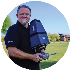
ABOUT EXTREME AERIAL

Established in 2014, Extreme Aerial Productions, LLC is a professional aerial drone video and photography company based in Scottsdale, Arizona. Operating various UAS, Extreme Aerial acquires imagery and processes data on projects throughout the US. For more information, visit www.extremeaerialproductions.com.

construction site

PROCESS LARGE PROJECTS AND
DELIVER HIGH-QUALITY RESULTS