CASE STUDY
Dual Collection With Lidar and Imagery: Extending the Value of Your Deliverables in One Flight
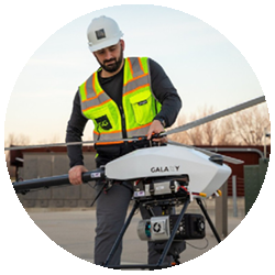
Lidar has no doubt been a game-changing technology in the world of surveying and mapping. But its predecessor, photogrammetry, continues strong due to its inherent quality of being easily interpreted as imagery. After all, points are points and pixels are pixels, how the mind interprets them can be very different. Merging the two technologies can speed up the creation of deliverables and enhance the useability of lidar, by making it more visually interpretable. With a background in lidar and image capture with drones, UAV Specialist Bradley Kruse at ISG, Inc, understands this. At ISG, an employee-owned multidisciplinary firm based in the Midwest, the use of UAV technology is prevalent on many of their projects. When these include mapping, SimActive’s Correlator3D is one of the many tools in his processing workflow.

INDUSTRY
Surveying
COUNTRY
United States
USE CASE
Using lidar and aerial imagery to support rapid deliverables for land development.
CHALLENGES
- Projects often in populated areas
- Minimizing time on site
- Maximizing value per mission
- Multiple flights over the project lifecycle
BENEFITS
- Dual collect, lidar and imagery
- Supplemental control from lidar
- Lidar derived DSMs
- Colorized point clouds

“Capturing both lidar and imagery, then combining them provides greater value to our engineers and surveyors working with these deliverables. We also benefit from the dual collection, because the lidar can be used to speed up processing in Correlator3D.”
BRADLEY KRUSE
UAV SPECIALIST AT ISG, INC.

WORKFLOW
One such project Brad’s team has been working on is a residential land development project. This site is surrounded by existing homes in a rural area. Brad is fortunate to have a UAV that carries both lidar and imaging sensors. Using a dual collection system minimizes the teams time on-site, ensuring other crews working on site can continue working with minimal stoppages. Once the project is captured, processing begins. The lidar is processed into a comprehensive single .las file in the software provided by its manufacturer. At this point, the .las file is used in various software platforms to extract additional information. One of those is SimActive’s Correlator3D. The .las is imported and converted into a DSM and an intensity image. The intensity image along with the DSM can then be used to extract additional GCPs for the AT process. Having the lidar derived DSM allows Brad’s team to skip the DSM generation process and move right to ortho and mosaic production. Once the mosaic is completed, they import the original .las file and colorize it using the mosaic. This adds that additional visually intelligence value to the lidar data, making it more understandable to others working with it. Which is the primary motivation for employing this process in Correlator3D.
DELIVERABLES
Typical deliverables include orthomosaics, digital terrain models, image-based point clouds, and volumetric reports.
BENEFITS
The benefits of using Correlator3D according to Brad is the ability to merge both the lidar and imagery into a more visually understandable deliverable. This makes the deliverables more accessible to others working on different phases of the overall project.
ABOUT ISG, INC.
Founded in 1973, ISG, Inc. is a nationally recognized multi-disciplinary design and engineering firm offering architecture, engineering, environmental and planning capabilities with over 400 employees and 11 offices throughout the United States. UAS operations include aerial imagery, video, and lidar acquisition. For more information, visit www.isginc.com.
