
July 9th, 2026
IMPROVING MAPPING ACCURACY THROUGH AERIAL TRIANGULATION WITH NEW CORRELATOR3D VERSION 11.1
- Processing challenging datasets with improved tie point extraction
- Simplifying multi-camera workflows
- Improving georeferencing with Direct Georeferencing and Assisted RTK/PPK
- Accelerating bundle adjustment and validating results using new visualization tools


June 11th, 2026
ARE RAPID ORTHOS BECOMING THE NEW STANDARD?
- Planning aerial acquisition for rapid ortho production
- Generating orthomosaics under tight operational timelines
- Delivering accurate outputs for operational planning and analysis
- Integrating rapid ortho workflows into real-world mapping operations

May 14th, 2026
MAPPING REMOTE ENVIRONMENTS: HOW DO YOU GET IT RIGHT?
- Planning aerial missions in remote and restricted airspace
- Capturing high resolution imagery for wildlife monitoring
- Managing complex aerial operations and sensor systems
- Processing large datasets to generate accurate environmental insights

April 16th, 2026
GAUSSIAN SPLATTING: IS IT WORTH THE HYPE?
- Planning data acquisition for optimal splats
- Generating splats with new Correlator3D version 11
- Visualizing, editing and sharing splats
- Exploring applications and real-world use cases

March 19th, 2026
MAPPING CRITICAL INFRASTRUCTURE: HOW DO YOU ENSURE ACCURACY?
- Designing efficient acquisition strategies for corridor environments
- Best practices for mapping linear and critical infrastructure
- Validating elevation accuracy with public lidar datasets
- Ensuring consistent quality for planning and analysis

February 24th, 2026
LARGE-SCALE AERIAL MAPPING: HOW DO YOU MAKE IT WORK?
- Choosing optimal sensors & settings for large areas
- Planning efficient missions for wide coverage
- Managing data volume and quality at scale
- Building processing workflows for massive datasets

January 22nd, 2026
SCALING PHOTOGRAMMETRY IN THE CLOUD WITH DISTRIBUTED PROCESSING: IS IT THE FUTURE?
- Running Correlator3D on cloud platforms like AWS and Azure
- Speed gains from distributed processing across multiple machines
- Dynamic scaling with cloud VMs for large projects
- Real-time monitoring and automatic task reassignment
- Cost optimization and performance best practices in the cloud

December 4th, 2025
PHOTOGRAMMETRIC ACCURACY REQUIREMENTS: HOW TO MEET THEM?
- Understanding the value of RTK/PPK
- Using GCPs vs. checkpoints
- Leveraging lidar as control
- Ensuring final quality

November 6th, 2025
MERGING LIDAR & IMAGES: HOW EASY IS IT?
- Choosing between simultaneous vs. separate acquisition
- Ensuring accurate registration between datasets
- Colorizing point clouds and generate orthomosaics
- Quantifying the accuracy of results

October 10th, 2025
PHOTOGRAMMETRY FOR ENGINEERING: HOW PRACTICAL IS IT?
- Planning effective imagery and lidar data collection
- Ensuring project accuracy through data processing
- Leveraging lidar’s added value for enhanced precision
- Evaluating data reliability for design and planning purposes
September 11th, 2025
USING DRONES FOR 3D CALCULATIONS: HOW ACCURATE IS IT?
- Choosing the right drone
- Setting up frequent data collections for real-time operational awareness
- Generating point clouds for detailed terrain analysis and planning
- Performing volume calculations to optimize ground operations

August 14th, 2025
MANAGING LARGE PHOTOGRAMMETRY PROJECTS SIMULTANEOUSLY: CAN IT BE DONE?
- Understanding input data
- Creating a scalable workflow
- Processing large image datasets
- Ensuring high-quality outputs

July 10th, 2025
MAPPING WITH DRONES: HOW QUICKLY CAN YOU DO IT?
- Choosing the right tools for mapping
- Planning effective data acquisition
- Streamlining processing for fast turnaround
- Mastering photogrammetry best practices

June 12th, 2025
DOES BETTER POSITIONING REALLY IMPROVE MAPPING ACCURACY?
- Choosing the right positioning systems
- Understanding their integration with sensors
- Importing positional data into Correlator3D
- Quantifying achievable accuracies

May 15th, 2025
IS PHOTOGRAMMETRY AS GOOD AS LIDAR?
- Choosing the right sensor
- Preparing the project for processing
- Measuring accuracy
- Merging technologies to improve results

April 17th, 2025
CREATING 3D MODELS FROM POINT CLOUDS
WITH NEW CORRELATOR3D VERSION 10.4
- Understanding the optimal sensors for 3D modeling
- Generating the best point cloud possible from imagery
- Performing triangulation to generate a texturized mesh
- Using lidar point clouds for modeling rather than photogrammetry

March 20th, 2025
MAPPING CORRIDORS WITHOUT CONTROL: MYTH OR REALITY?
- Planning for successful corridor mapping
- Setting up a project with direct georeferencing
- Understanding achievable accuracies
- Editing surfaces and mosaics to improve results
February 20th, 2025
DO LARGER FORMAT SENSORS INCREASE MAPPING PRODUCTIVITY?
- Determining your project requirements
- Choosing the right imaging sensor
- Understanding the impact of sensor size on processing
- Simplifying your processing workflow
January 23rd, 2025
MANAGING LARGE PHOTOGRAMMETRY PROJECTS WITH NEW CORRELATOR3D VERSION 10.3
- Preparing to process large projects
- Best practices for success
- Speeding up processing with multiple PCs
- New features of version 10.3

December 5th, 2024
WHAT ARE THE ADVANTAGES OF LIDAR WITH DRONES?
- Understanding the benefits of lidar and imagery
- Selecting the proper hardware configuration
- Planning for dual acquisition
- Merging lidar and photogrammetry in C3D

November 7th, 2024
MAPPING WATER: CAN YOU REALLY DO IT?
- Considerations before flight
- Options for successful aerial triangulation
- Ways to fix DSMs/DTMs
- Solutions to ensure the quality of mosaics
October 10th, 2024
CAN RTK/PPK REALLY REMOVE THE NEED FOR GCPs?
- Understanding RTK/PPK for drones
- Supplementing with GCPs
- Managing accuracy with Correlator3D
- Confirming the quality of results
September 12th, 2024
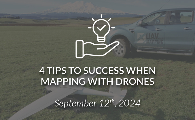
4 TIPS TO SUCCESS WHEN MAPPING WITH DRONES
- Planning for what you’re mapping
- Choosing the right drone for the mission
- Developing processing workflows
- Understanding options in Correlator3D
August 15th, 2024
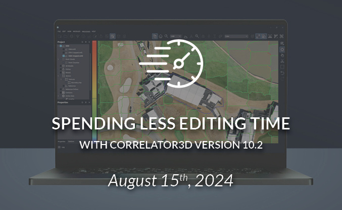
SPENDING LESS EDITING TIME WITH CORRELATOR3D VERSION 10.2
- Streamlining mosaic editing
- Selecting specific ortho for inclusion
- Editing point clouds prior to export
- Performing quality control in real-time
July 11th, 2024
ARE LARGER FORMAT CAMERAS BETTER FOR MAPPING?
- Different camera formats & footprints
- Benefits of larger format sensors
- Effects on resolution and quality
- Considerations during processing to ensure success

June 13th, 2024
FIXED-WING DRONES: ARE THEY BETTER THAN MULTI-ROTOR?
- Advantages of fixed-wing drones over multi-rotor
- Projects that benefit from fixed-wing
- New fixed-wing payload options
- Unique processing challenges
May 16th, 2024
MAPPING HILLY TERRAINS WITH DRONES: IS IT POSSIBLE?
- Choosing the right drone for a project
- Considerations in planning missions over hilly terrains
- Flying drones in difficult environments
- Managing challenges with processing large datasets
April 18th, 2024
OBLIQUES FOR MAPPING: ARE THEY REALLY USEFUL?
- The difference between nadir and oblique imagery
- Mapping vs 3D modeling
- Considerations for successful oblique imagery acquisition
- Processing options in Correlator3D

March 21st, 2024
GCPs FOR PHOTOGRAMMETRY: HOW MANY DO YOU NEED?
- Why do placement and size of GCPs matter
- Why is distribution important
- How other technologies such as RTK/PPK play a role
- How many GCPs are required
February 22nd, 2024
CLEANING UP DRONE IMAGES BEFORE PROCESSING: DOES IT PAY OFF?
- Validating exterior orientations and camera information
- Identifying and removing unnecessary images
- Choosing the right workflow for the project
- Taking a hands-on approach to processing
January 25th, 2024
PHOTOGRAMMETRY IN THE CLOUD: IS IT A GOOD IDEA?
- What cloud processing is, and what are the platforms
- Considerations in using cloud processing vs local
- Challenges and costs of associated with the cloud
- Processing time gains
December 14th, 2023
UPCOMING MAPPING TRENDS FOR 2024
Interview with Miriam McNabb,
Editor in Chief at DRONELIFE
November 16th, 2023
HOW TO SAVE TIME AND MONEY ON PHOTOGRAMMETRY PROJECTS
- Common challenges and impact on costs
- Cost variations as projects increase in size
- Workflows in Correlator3D to minimize man-hours
- Accelerating timelines with distributed processing

October 19th, 2023
CAN 10,000 DRONE IMAGES BE PROCESSED OVERNIGHT?
- Capturing thousands of images
- Validating and preparing raw imagery
- Processing large projects with Correlator3D
- Preparing results for delivery
September 14th, 2023
3 WAYS TO SPEED UP PHOTOGRAMMETRY
- Selecting platforms and sensors to best match projects
- Mission planning for efficient data collection
- Setting up projects in Correlator3D and validating input data
- Doubling DSM and point cloud processing speeds with new version 10.1
August 17th, 2023
CAMERAS ON DRONES AND AIRCRAFT: IS BIGGER ALWAYS BETTER?
- Analyzing the different camera types and sizes available
- Understanding the factors affecting camera quality
- Selecting a camera for photogrammetry
- Processing data from any camera with Correlator3D

July 20th, 2023
MINING SITE MONITORING USING DRONES
- Flying a drone over a mining site
- Vetting the resulting imagery and accuracy
- Producing base map products with Correlator3D
- Analyzing geospatial data to monitor the site
June 22nd, 2023
RTK/PPK vs GCPs: WHICH ONE DO YOU NEED?
- What is the difference between RTK and PPK
- How RTK/PPKs affect aerial triangulation
- When are GCPs needed
- How accuracy is validated
May 25th, 2023
HOW TO MEET PHOTOGRAMMETRIC ACCURACY STANDARDS
- What is an accuracy standard
- How is a well-accepted standard such as ASPRS defined
- How does new technology affect accuracy standards
- How are mapping deliverables validated against a standard
April 17th, 2023
GENERATING POINT CLOUDS AT HIGHER DENSITIES WITH C3D V10
- Using the redesigned UI including new light/dark modes
- Increasing the densities of point clouds
- Adding oblique imagery to improve results
- Colorizing photogrammetric point clouds automatically
- Filtering out points with lower accuracies
March 23rd, 2023
MANAGING LARGE CORRIDOR PROJECTS USING DISTRIBUTED PROCESSING
- Challenges in managing large corridor mapping projects
- Running Correlator3D in the cloud
- Advantages of distributed processing
- Time savings with scripting
February 23rd, 2023
MINIMIZING COST OF DRONE MAPPING PROJECTS
- Typical drone mapping project costs
- Cost variations as projects become larger
- Workflows in Correlator3D to minimize man-hours
- Using multiple PCs to accelerate processing

January 26th, 2023
COMBINING LIDAR WITH IMAGING DATA FOR DRONE MAPPING
- Value of integrated lidar and imaging sensors
- Optimizing workflows with dual systems
- Using Correlator3D to confirm data accuracy
- Creating high-quality point clouds and mosaics

December 1st, 2022
HOW TO IMPROVE YOUR PHOTOGRAMMETRIC WORKFLOWS
- Best practices for project setup
- Generating high quality DSM/DTMs, point clouds,
and orthomosaics
- Solutions to optimize processes
- Highlight capabilities of C3D Version 9 and a sneak peek at Version 10

October 27th, 2022
OPTIMIZING PHOTOGRAMMETRY IN SOUTHEAST ASIA
- Acquiring imagery where terrain is a factor
- Acquiring imagery where weather is a factor
- Flight planning
- Processing workflows

September 29th, 2022
HOW TO USE PHOTOGRAMMETRY TO CALIBRATE SENSORS
- Choosing the right sensor
- Collecting optimal data for calibration
- Performing sensor calibration
- Monitoring sensor performance over time

September 1st, 2022
CHOOSING THE RIGHT CAMERA FOR YOU PHOTOGRAMMETRY PROJECT
- Types of cameras used in aerial mapping
- Single sensor vs multi-sensors
- Additional components (e.g. IMUs, stabilized mounts)
- Factors affecting accuracy
- Processing workflows

August 4th, 2022
WHEN, WHY AND HOW TO USE RTK/PPK IN PHOTOGRAMMETRY
- Differences between RTK & PPK
- Factors impacting accuracy
- Processing options in Correlator3D
- When to use RTK/PPK
- Troubleshooting results

June 30th, 2022
PROCESSING PHASE ONE IMAGERY WITH CORRELATOR3D VERSION 9.2
- Choosing the right Phase One imaging sensor
- Understanding the Intelligent Image Quality
(IIQ) format
- Determining when to use IIQ format
- Setting up IIQ projects in Correlator3D


June 2nd, 2022
DRONE VS AIRCRAFT CHOOSING THE RIGHT PLATFORM FOR MAPPING
- Differences between cameras and positioning systems
- Coverage area per mission
- Costs associated with acquisition
- Differences in processing workflows

April 28th, 2022
CORRIDOR MAPPING FOR INFRASTUCTURE USING DRONES
- Planning corridor mapping projects
- Importing and merging different sensor data
- Batch processing via scripting
- Editing output data


March 31st, 2022
INCREASING PRODUCTIVITY WITH NEW CORRELATOR3D VERSION 9.1
- Managing multiple LAS files
- Setting up email notifications to monitor processing
- Processing imagery from the new Red Edge P sensor
- Importing data from the Pléiades Neo satellite
March 3rd, 2022
PHOTOGRAMMETRIC WORKFLOWS TO IMPROVE OUTPUTS FOR INFRASTUCTURE PROJECTS
- Creating better surfaces with DEM editing tools and processes
- Developing workflows for infrastructures such as buildings, bridges and elevated roadways
- Inspecting surfaces through visualization
- Using DEM-based options for ortho and mosaic creation

January 27th, 2022
USING LIDAR TO ENHACE PHOTOGRAMMETRIC WORKFLOWS
- Setting up a photogrammetric project
- Importing a lidar DEM and intensity image
- Using lidar as supplemental control
- Colorizing point clouds

December 9th, 2021
STEAMLINING PHOTOGRAMMETRIC WORKFLOWS WITH SCRIPTING AND COMMAND-LINE PROCESSING
- Designing simple scripts in the GUI
- Executing scripts with the GUI vs command-line
- Batch processing via scripts
- Editing output data
- Saving scripts for reuse

November 11th, 2021
CREATING MAP PRODUCTS WITH CORRELATOR3D AND SKYDIO DRONES
- Mission planning
- Data acquisition and post-processing
- Generating DSMs, DTMs, and orthomosaics
- Assessing final project accuracy
October 7th, 2021
DISTRIBUTED PROCESSING WITH NEW CORRELATOR3D VERSION 9.0
- Configuring a suitable network
- Discover available PCs for processing
- Dispatch processing on specific PCs
- Monitor processing on the different PCs in real-time
- Dynamically adjust computer power during processing
September 14th, 2021
HOW TO ACCURATELY MERGE IMAGERY WITH LIDAR
- Importing LiDAR point clouds
- Registering LiDAR data and images automatically
- Orthorectifying on LiDAR DEMs
- Colorizing LiDAR point clouds


August 5th, 2021
INCREASING EFFICIENCY OF VOLUME CALCULATIONS WITH DRONES
- Understanding input requirements for accurate measurements
- Using the proper calculation methodology
- Scaling and automating over multiples stockpiles
- Assessing accuracies of volume measurements


June 23rd, 2021
SPEEDING UP PHOTOGRAMMETRIC PRODUCTION DURING PEAK SEASON
- Large-scale projects
- Continuous stream of projects
- Multi-mission projects
- Single projects with discontinuous areas

May 27th, 2021
HOW TO USE METRIC CAMERAS FOR ACCURATE MAPPING
- Collecting optimal imagery
- Assessing quality of results
- Performing aerial triangulation
- Generating accurate DSMs and DTMs
- Creating seamless orthomosaics
- Working in different real-world scenarios

April 29th, 2021
SURVEYING LARGE AREAS WITH VTOL DRONES
- Mission planning
- Data acquisition and post-processing
- Assessing final project accuracy
- Generating DSM, DTM and orthomosaic


March 25th, 2021
HOW TO PERFORM HIGH-ACCURACY DRONE MAPPING WITHOUT GCPs
- Mission planning
- Data acquisition and post-processing
- Performing aerial triangulation with PPK
- Generating DSM, DTM and orthomosaic

February 25th, 2021
SPEEDING UP DRONE MAPPING PROJECTS
- Controlling quality of input imagery
- Generating dense DSMs, DTMs and 3D models
- Producing accurate orthomosaics
- Sharing and visualizing resulte on the web


January 26th, 2021
PROCESSING LARGE DRONE PROJECTS
- Collecting optimal drone imagery
- Performing aerial triangulation
- Generating DSMs, DTMs and orthomosaics
- Optimizing processing workflows
- Assessing final project accuracy


December 10th, 2020
HOW TO ACCURATELY MERGE IMAGERY WITH LIDAR
- Importing LiDAR point clouds
- Registering LiDAR data and images automatically
- Orthorectifying on LiDAR DEMs
- Colorizing LiDAR point clouds


November 12th, 2020
IMPROVING YOUR PHOTOGRAMMETRIC WORKFLOW WITH THE NEW VERSION 8.6
- Review of Correlator3D processing options
- Processing multispectral data
- Handling single image satellite projects
- Improving mosaic seamlines with DSM


October 8th, 2020
HOW TO QUICKLY GENERATE HIGH-QUALITY ORTHOMOSAICS
- Choosing between DTM-based vs true orthos
- Generating mosaic from individual orthos
- Assessing mosaic accuracy
- Editing mosaic seamlines
- Creating NDVI maps

September 10th, 2020
HOW TO IMPROVE THE QUALITY OF DRONE MAPPING PROJECTS
- Collecting optimal drone imagery
- Performing quality control on raw data
- Cleaning-up input datasets
- Optimizing processing workflows


August 6th, 2020
HOW TO MANAGE PHOTOGRAMMETRIC PRODUCTION DURING PEAK SEASON
- Large-scale projects
- Continuous stream of projects
- Multi-mission projects
- Single projects with discontinuous areas

July 8th, 2020
CUSTOMIZING YOUR MULTISPECTRAL DATA PROCESSING
- Using calibrated reflectance panels and sun sensors
- Registering multispectral bands
- Producing multiband orthomosaics
- Creating vegetation index maps
June 11th, 2020
HOW TO CALIBRATE AND PROCESS
MULTISPECTRAL IMAGERY
- Using calibrated reflectance panels and sun sensors
- Registering multispectral bands
- Producing multiband orthomosaics
- Creating vegetation index maps


June 10th, 2020
HOW TO SHARE AND VISUALIZE DRONE PROJECTS IN THE CLOUD
- Generating maps from drone imagery
- Exporting results to the cloud
- Creating shareable web links
- Visualizing geospatial data online

May 21st, 2020
HOW TO EFFICIENTLY PROCESS SATELLITE IMAGERY
- Preparing imput data and pairing images
- Refining RPCs through aerotriangulation
- Generating high-resolution DSMs and DTMs
- Creating seamless orthomosaics
- Pansharpening of multispectral images

April 30th, 2020
HOW TO USE METRIC CAMERAS FOR PRECISE MAPPING
- Collecting optimal imagery
- Assessing quality of results
- Performing aerial triangulation
- Generating accurate DSMs, DTMs
- Creating seamless orthomosaics

April 8th, 2020
SPEEDING UP PROCESSING OF LARGE DRONE PROJECTS
- Performing aerial triangulation
- Producing mosaic of orthophotos
- Assessing final project accuracy
- Generating DSM, DTM and orthomosaic

March 12th, 2020
ACCELERATING VOLUME MEASUREMENT WITH DRONES
- Understanding requirements for precise measurements
- Using a proper reference elevation
- Automating volumetric calculation
- Assessing accuracies of volume measurements
February 13th, 2020
HOW TO OPTIMIZE ACCURACY OF DRONE MAPPING PROJECTS
- Understanding input data requirements
- Selecting bundle adjustment parameters
- Calibrating sensors
- Understanding AT results and reports
- Performing direct georeferencing